Sunday, February 6, 2011

Biodiversity of Southern Florida

Disclaimer:
This is NOT a scholarly article; just a travel review of the national parks of Florida.
----------

The sunshine state is well known for its crystal beaches, tropical climate, and an array of amusement parks in the city of Orlando. However, there is much more in it, though not so popular among conventional tourists, but a true feast for nature lovers. In addition to all the popular tourist sites, the state has been endowed with a wide diversity of wildlife including a number of endangered species. There are several protected areas for this rich biodiversity, which include Everglades National Park and Biscayne National Park at the southern part of the state. The major part of the state is strategically placed between two major bodies of water; the Atlantic on the east coast and the Gulf of Mexico on the west. This unique geographical location is the principal reason for sustaining the biodiversity.

If you continue on I-95 towards south of Miami, it merges onto US-1 around Coconut Grove and becomes South Dixie Hwy. After driving for another 28 miles you will reach Florida City, the southernmost city in mainland US which is not on an island. In the center of the city lies the crossing of S Dixie Hwy and Palm Drive. This last crossing on S Dixie Hwy traps you in a dilemma. If you go westbound you will hit Everglades National Park (Gulf of Mexico coast) in about 20 min. If you choose to go to east you will reach Biscayne National Park (Biscayne Bay, Atlantic coast) in about 25 min.

In our entire stay in US, we came to the crossing twice, once in Dec 2009 and once in Dec 2010. We were lucky enough to have visited both the national parks, but on two different trips one year apart. The first trip, where we went westbound, was part of a Christmas vacation when we roamed around the whole state of Florida. The last one was just meant for Biscayne and greater Miami metropolitan area. So fond we were of the crossing, that we would love to visit there time and again.

Everglades

Everglades neither has the grandeur of Yellowstone or Grand Canyon, nor the sheer relief of Rockies or Smokeys. But it does have something that draws attention of thousands of nature enthusiasts every year. You just need to recognize its own unique beauty. This is the ultimate place for tropical wildlife watching in Southern Florida, though most of the park is inaccessible. The accessible parts of the park can be covered in one day, and for us that one day was the New Years Day in 2010. On the last day of 2009 we traveled to and from Key West in a single day. We enjoyed the firecrackers on the way to Homestead, and returned to our motel much after midnight. The New Years Day was supposed to be hectic. But we started early towards Everglades, despite being sleepy.

American Alligator (Alligator mississippiensis)

The journey started at the Ernest Coe Visitor Center near the main entrance of the park. The Royal Palm Visitor Center is just 4 miles away from there. This place was infested with turkey vultures. A dead vulture was hanging on top of the visitor center; this exhibition was supposed to scare the hell out of the living ones.

Florida Redbelly Turtle (Pseudemys nelsoni)

The Anhinga Trail starts from Royal Palm. Nothing less than an amusement park, this 0.8 mile loop trail is a must see for people of all ages. If SeaWorld decides to have an “Everglades Ride”, this is what it should look like ideally. This is mostly on a boardwalk, which offers closest possible encounters with fearsome alligators and crocodiles and cool turtles. And by closest I mean inches, without exaggerating anything. Surely you can pose for nice snaps with them without being worried. Those cold-blooded creatures, in the course of their languid sunbathing, care little about the nearby two legged animals. However, one may invite disaster if he/she tries to play games with them. The best thing about the park is that the food chain in the ecosystem is maintained naturally, without any interference from the park rangers. That means the alligators feed on naturally occurring aquatic species.

Great Blue Heron (Ardea herodias)

Apart from the reptiles, a whole variety of the avian species can be watched all the way through this trail, again from a very close distance. The Anhingas can be seen standing gracefully on wooden pillars; not bothered by the presence of the descendants of monkey species (us). The reflections of green herons and reddish egrets on the water surface; the nosedive of ospreys to snatch fish; all create picture perfect moments.

Water Turkey (Anhinga anhinga)

The park ranger informed us that nearly 350 bird species can be found in Everglades, which includes wood stork, brown pelican, white and glossy ibis, roseate spoonbill, to mention just a few. In addition, it also hosts a large number of smaller migratory birds.

Green Heron (Butorides virescens)

The Main Park Road is a scenic 38 mile drive from Coe to Flamingo Visitor Center. Several walking trails can be accessed by the side of this road. We chose to explore the 0.4 mile Mahogany Hammock Trail, which passes through a dense, jungle-like hardwood hammock (slightly higher elevated tree island). At the end of the scenic drive the Flamingo area generously offers a variety of activities to the travelers. The most interesting amongst them is wildlife watching from the visitor center breezeway. A number of gators and endangered crocs laze around the vicinity of Flamingo marina. A variety of birds assemble on the Florida Bay mudflats as well as on the Eco Pond.

Tricolored Heron (Egretta tricolor)

To appreciate the real Everglades one needs a boat. Since we didn’t have one, we went for a narrated boat ride into the Florida Bay. The main attraction was to study some endangered manatees and bottlenose dolphins. We were neither lucky nor unlucky; just had to satisfy ourselves with occasional views of dolphin fins above the water surface.

Roseate Spoonbill (Platalea ajaja)

With the setting sun, our daylong visit at Everglades was concluded. Hoping to come back at some other suitable time, we started our cross-country return journey through Big Cypress National Preserve.

Biscayne

The sole purpose of our second visit to the Miami was to explore Biscayne National Park and Biscayne Bay in general. The rationale was that the biodiversity on land is just the beginning. The real escapade begins when you hit the waters rich with sundry marine life. For several decades, the shoreline of Biscayne Bay had attracted marine aficionados from all parts of the globe. Biscayne National Park is probably the best place in Florida for up close and personal interaction with coral reefs. Only 5% of the park is land, consisting of a mangrove shoreline and about 40 barrier reef islands. The majority of the wilderness lies under the water.

Double-crested Cormorant (Phalacrocorax auritus)

For beginners, corals are tiny animals, termed as polyps, which assimilates calcium ions from seawater and produces fortifications of limestone around themselves. The array of those adjoining fortifications appears like colonies of flowers or mountains. When colonies of several species are placed in close proximity to each other, they emerge as living fortresses termed as reefs. Apart from corals, there exist sea whips and sea fans inside the reefs. Their back and forth movement alongwith the sea current gives life to the otherwise stagnant reefs.


To spice up the matter, about 200 species of colorful fishes dwell on the reefs. Some of the popular ones include blue marlin, red grouper, damselfish, parrotfish, etc. A number of endangered sea turtles such as loggerhead, leatherback and green sea turtle, as well as shark, stingray, jellyfish, crab, sponge, starfish, etc. are residents of this part of the world. Scores of these species acquire food and shelter in the coral reefs. Being closer to Miami, the nightlife in the reef is amazing. A “bottom up shift” of the ecosystem always occurs at the turn of the day, which optimizes the utilization of the abundant food supply.


The best way to explore the reef is scuba diving, which was not our cup of tea. The second best option was snorkeling, which we tried the previous year at Key West, but not with great success. This time, to be doubly sure, we opted for both the glass boat tour and snorkeling, so that we could make an overkill of our visit. Both are 3 hour tours, managed by Biscayne National Underwater Park. Needless to say, both the outings were more than successful. They took us out front of Elliott Key Oceanside, where tons of patch reefs exist. The depth of water ranges from 10–15 feet, which is ideal for snorkeling. Words fall short to describe the views underneath the water. However, the astonishing views of the corals and fishes and stingrays could not be documented properly on camera. We managed to get a cheap disposable waterproof camera, which did not have the finesse of a simple point-and-shoot digital camera. So we had to be content with what our eyeballs captured.


Great Blue Heron (Ardea herodias)

A large number of avian species accompanied us during both the tours, and our guide was nice enough to introduce them to us. A majority of them recognized us; probably saw our faces during the Everglades excursion.


Wood Stork (Mycteria americana)

In spite of spending so much time with the corals, we still had some surplus time before our return flight. We exploited that by kayaking on the Atlantic waters. Believe it or not, this is far more dangerous than that on the Charles or the Massachusetts Bay. As usual, birds were our only companions during the adventure, and enabled us to spend quality time far from bustling city life. Our last trip to the sunshine state was aptly concluded by a spectacular sunset over the Biscayne Bay, witnessed from Bill Baggs Cape Florida State Park.

Sunday, December 5, 2010

The Valley of Death

Disclaimer:
This is not a horror fiction. Just a travel review of Death Valley National Park.
------------------------------------------------------------

Which national park in the world has the scariest name? The first answer that comes to mind is Death Valley. Despite its creepy name, Death Valley National Park is one of the most strikingly beautiful places on the earth. From the second lowest point in the Western Hemisphere to the hottest point on earth; from 282 ft below sea level to 11,000 ft above sea level; from salt flats to sand dunes; from vibrant canyons to gigantic volcanic craters, this national park is rich with unique geological features. Located between the Great Basin and Mojave Desert, it is the largest national park (area 13,650 sq km) in the mainland US.

We were introduced to the name of Death Valley at a very young age through geography lessons and popular Bengali science fiction. So when the time finally came to visit the Sin City, we gave our best shot towards a daylong tour to DVNP. We started pretty early in the morning, and chose the easiest route, that is the Hwy 95 N route via Indian Springs. After driving 90 miles on Hwy 95 N from Vegas to Lathrop Wells, we switched to Hwy 373, which meets the NV-CA State Line Road at Death Valley Junction after a 25 miles drive. The whole drive of 115 miles through a desolate region felt like a never-ending one.

The distance from Death Valley Junction to Dante’s View Turnoff is 18 miles on Hwy 190. We took a detour on the Dante’s View Road which leads to Dante’s View, arguably the most spectacular viewpoint in the park. This overlook stands at 5475 ft above sea level. The 360° panoramic view from the summit portrays mountain ranges in all directions, which include the Sierra Nevada Mountains (NW), the Grapevine Mountains (N), Mount Charleston (E), and the mountains around Los Angeles (SW). Furthermore, a sweeping view from the floor of Death Valley to the summit of Telescope Peak can be experienced from here.
From -282 ft to +11000 ft, a sweeping vista from Dante's View

Turning back to Hwy 190, another 10 miles drive took us to Furnace Creek Visitor Center. Did the name Furnace Creek ring a bell? Yes, it did. Our textbook knowledge of Death Valley hammered us with the fact that this place had been credited for highest temperature ever recorded (56.7 °C, in 1913) on earth. That justifies the “furnace” in its name. However, in the month of November, the surroundings were pretty cool. The junction of Hwy 190 and Badwater Road is exactly at sea level. From there, one can only go downhill on the Badwater Road and feel the ensuing pressure drop.

The first important stop on the Badwater Road is the Golden Canyon Trailhead. Though our feet were not completely healed from previous month’s Grand Canyon experience, still we opted for this trail, which extends till Zabriskie Point (2.5 miles one way). However, we chose to explore until Red Cathedral (1.5 mile from trailhead) only. This is a moderate trail with elevation gain upto 320 ft. From the start to the end, the trail greeted us with swirls of color, including gray, red, brown, yellow and orange. Golden Canyon conserves geographical legends of the entire DVNP like a virtual wikipedia. The rocks and canyon walls shout out the untold tales of the ancient lakes and showcase the effect of flash floods in a parched land.
Red Cathedral at Golden Canyon Trail

The next stop was the Devil’s Golf Course, which is an immense area of rock salt eroded by wind and rain into jagged spires. Once swathed by a lake, the water evaporated a couple of centuries ago, and left behind large infernal stalagmites and spiky mounds of salt and minerals. A one mile dirt road leads to the parking area, which immediately lures the visitors to step inside the salt pinnacles. But believe me, they are very sharp and makes it very tricky to walk, let alone playing golf. That reminded us of a Bengali proverb about sprinkling salt to an injury. We did not hesitate to salute the person who named this place for his/her uncanny sense of humor.
Devil's Golf Course

Our hiking spree has got the best of us again, so unsurprisingly we stopped at the Natural Bridge Canyon Trailhead. From the trailhead, the 50 ft tall Natural Bridge is only half a mile walk. Being created by differential erosion, this is obviously the main attraction of the canyon, but the trail has more to offer. Analogous to other canyons of the park, a rich display of the geological history is evident through the towering reddish cliffs. In the metamorphic rocks, cute swirls of blue, red, gray and white are prominent. The entire trail is 2 miles roundtrip, gains elevation upto 800 ft, and dead-ends at a 20 ft pour over blocking the canyon.
Natural Bridge Canyon

About 6 miles on the Badwater Road, we finally arrived at the Badwater Basin, which has a surreal landscape of vast salt flats. At 282 ft below sea level, this is the lowest point in North America and second lowest point in the Western Hemisphere. The boardwalk ends where there are some wonderful pressure ridges and cracks in the salt. Apart from the picturesque view of the Telescope Peak (11,049 ft) just across the valley, the Black Mountains (6,000 ft) rose directly out of the salt flats behind the trailhead with a glittering sign indicating the sea level.
Badwater Salt Flats, lowest point in North America

During return, we took another detour through the Artist’s Drive, located about halfway between Furnace Creek and Badwater Basin. This is a 9 mile one way scenic loop drive running through multicolored igneous and sedimentary rocks resembling a grand painter’s palette. Driving through the sharp curves and deep dips felt like a roller coaster ride. The Artist’s Palette vista point is a unique landmark in DVNP and is incredibly photogenic in the late afternoon, especially when the colors start to pop-up with the gradual softening of sunlight. The arrays of the red, yellow, green, blue and purple colors have been created by salts of the first transition metals, mostly Fe and Mn. The whole drive also substantiates one of the most violently explosive volcanic periods. Leave aside history and geography, at the end of the day Artist's Drive is a heavenly place where all superlatives become trivial.
Artist's Palette, incredibly photogenic in the afternoon

After arriving at Furnace Creek again, we were headed further north towards Stovepipe Wells. Few miles down the way, the non-operational Harmony Borax Works symbolizes the erstwhile industrial activity more than a century ago. The ruins of an old cotton-ball borate ore boiling facility and a 20 Mule Team borax wagon train are the primary exhibits in this area. Interestingly, this place also stands 260 ft below sea level.

The principal features of the Stovepipe Wells area are the Mesquite Flat Sand Dunes and the Mosaic Canyon; with contrasting characteristics but equally stunning landscapes. While the sunrays of late afternoon accentuated the golden colored ripples of the smoothly rising dunes, the water-polished conglomerate rocks of the Mosaic Canyon represent the finest of the DVNP.
Mosaic Canyon

It was time to wrap up. So many things to do, but so little time we had. We heard a lot about Scotty’s Castle, Ubehebe Crater and Telescope Peak. But we were badly running out of time, and had to start our return journey with heavy heart and optimistic mind. We saved the best for the last, which is the Zabriskie Point, just east of Furnace Creek. Surrounded by a maze of vividly colored eroded mudhill badlands, this is the most popular destination for watching sunset inside the park.

Sunset from Zabriskie Point
 
The trip was concluded by another scenic drive through Twenty Mule Team Canyon. Winding through ethereal wilderness, this 2.7 mile one-way loop drive is unpaved, but equally gorgeous compared to the other scenic drive we took earlier in the day.

Sunday, November 7, 2010

The Majesty of Grand Canyon

This review is dedicated to all the fellow travelers who saved our life at South Kaibab Trail.


The Grand Canyon from Yaki Point


What is considered as one of the seven natural wonders of the world can hardly be described in a single travel review. We could write all day about what an amazing sight is ahead of you and what a spectacle it is. Yet, at the end of the day words do no justice to it.


Isis Temple

There might be a number of “Grand Canyons” in other parts of the world. But this is THE Grand Canyon. Universally famous for the combination of large size and depth, the exposed layering of colorful rocks dates back to the prehistoric times. The easiest way to remember the formation of Grand Canyon is the word DUDE, which stands for Deposition – Uplift – Down Cutting – Erosion.


Vishnu Temple

Perhaps it's no surprise, but the lure of the canyon induces a lot of visitors to leave the rim and head downward towards the Colorado River. Our personal recommendation is that one should always find a way to make that a part of the canyon experience, whether he/she is at the South Rim or the less-visited North Rim.


Sunrise from Yaki Point


Day 1: Arrival

We made it to the South Rim of Grand Canyon National Park in the month of October, where the off-season timing reduced the large numbers of people. We arrived there at late afternoon after a 240 miles (384 km) drive from Phoenix Airport. We barely managed to catch the stunning views of sunset from the Yavapai Point. The camping experience at Mather Campground, as it must be in a national park, was fun. People might find hotels outside the park boundary or can also avail the log cabins available but spending the nights so close to nature cannot be enjoyed in any better way than to camp in the park.


The end of "Trail of Time" near the Grand Canyon Village


Day 2: Exploration of the South Rim

The next day started with sunrise at Yaki Point and ended with sunset at Lipan Point. We spent the whole day going from one vista point to the other along the Rim Trail and Desert View Road. We were somewhat in awe of the “Trail of Time” that extends along the rim for what feels like miles. This starts from the Yavapai Point and continues through the Grand Canyon Village. About 2 billion years of earth's geological history, supplemented by spectacular specimens of rocks from the bottom of the canyon, have been exhibited throughout the trail.


Vishnu Schist – the oldest exposed rock layer in the canyon

Inside the park, the important vista points include Hermit's Rest (and all other points on the Hermit Road), Yavapai Point, Mather Point, Yaki Point (ideal for sunrise), Grandview Point, Navajo Point, Lipan Point (ideal for sunset) and Desert View.

One important thing we learnt from visiting the vista points is that a lot of the views look identical. The canyon is so vast that one can only get a slightly different perspective from adjacent viewing points. So it is worthwhile taking this into account when one plans to visit there. More so it also gives us a idea of its vastness and what seemed a long distance for us to get us enough tired, was actually small enough for the canyon to barely show any change in its view.

Colorado river from Navajo Point

The most popular point for sunrise is Yaki Point, and that for sunset is Hopi Point in the Hermit Road. But for a quieter and serene atmosphere, I would recommend Lipan Point near the Desert View, where the experience was overwhelming. The changing color of sunset was better than anything we have ever seen. The sharp turns and rapids of the Colorado River can be best seen from the Navajo Point on the Desert View RoadThe Desert View boasts of a historic watchtower designed by famous architect Mary Colter.


The Abyss at twilight, from Lipan Point


Day 3: Deep Dive into the Canyon

As it was said from time to time, one hasn’t really seen the Grand Canyon until it is observed from inside of the canyon. Leaving the crowds of Grand Canyon Village behind was always a part of our plan. And we found that heading down the canyon's steep slopes gives a much better feeling for the grandeur and scale of the place.


Sunrise at O'Neill Butte

From the South Rim, the most popular hiking trail is the Bright Angel Trail (9.5 miles one way), which is one of the two well-maintained routes to the river. It is also heavily travelled, but this is the place for first-time hikers or those who are concerned about safety. The route is broad, and rangers patrol it frequently all throughout the day. However, according to our fellow travelers, the South Kaibab Trail (7 miles one way) provides much better panoramic views all the way to the bottom, whereas the Bright Angel Trail is mostly inside a canyon, and therefore hides most of the views.


The trail from Tip Off

The biggest issue in the South Kaibab Trail is the safety of the adventurers. This is steeper than the Bright Angel, there is no supply of drinking water and the restrooms are not maintained during the off-season. The late summer squeezes every last drop of moisture out of the hiker whenever he/she goes deeper. It's easier going downhill, although our aging knees beg to differ. But normally people get themselves in trouble when they don't have enough resources for a trip down and back, which includes salty food, enough water and energy drinks. It seems obvious to point out, that a good pair of running shoes is recommended for canyon hiking. Anything less can bring serious trouble and can become fatal. Most importantly, no one can come and get you out of there easily if you turn an ankle or stiffen a knee.


Colorado river from the trail


The Descent
We left our car at the visitor center, took the shuttle bus to the trailhead (since there is no designated parking there), and started before sunrise. Just below Yaki Point, the trail begins with a series of switchbacks. From Ooh Aah Point, the trail follows the top of a ridgeline through Cedar Ridge (1.5 miles from rim). After that, the trail traverses below O'Neill Butte to Skeleton Point (3 miles from rim) without a single switchback. Thereafter, the trail descends rapidly towards Tip Off (4.4 miles from rim) via another series of switchbacks.


Kaibab Suspension Bridge

The rangers recommend using this trail to descend only, because it is very steep and shadeless, but offers stunningly dramatic views. By the time we reached the Kaibab Suspension Bridge, one of us managed to get a stiffened knee and another got back pain. Though we were overwhelmed by the breathtaking views, carrying DSLR cameras and big lenses felt like a big burden, forget about using them. After reaching the Bright Angel Campground (7 miles from rim) at the bottom end of the canyon, we became little tensed thinking about the upcoming ascent. The whole descent took nearly four hours, which was pretty awesome considering our rusted joints.


Bright Angel Creek at the bottom of the canyon


The Ascent
Though the slightly longer Bright Angel Trail (9.5 miles one way) is much shadier and less steep, we again chose the South Kaibab Trail (7 miles one way) for the ascent; just to save the two and a half extra miles. When we started the epic ascent, we felt like lying down on the stones and prayed for some miracle to happen which will teleport us to the rim. We desperately wanted that in the whole ascent of eight hours with the increasing pain that one of us was suffering from the stiffened knee. Asking for help from park rangers went in vain. We would not have survived severe dehydration if not for some of our fellow travelers who helped us with ample water, energy drinks, and some herbal treatment for the knee. 

Giving way to the mules at a switchback


Near the Ooh Aah Point a heavy thunderstorm started along with a drizzle. The strong gusts of winds gave us a challenge to keep the body balance intact along the edge of the trail and not take a shortcut to heaven. To add to our misery, our sunglasses went flying and forced us to withstand the dust with bare eyes. Thanks to a piece of rock where they got stuck and we could recover them.

The last quarter of the hike was the most frustrating one. It looked like we had almost made it to the top for the last two hours or so, but the tight switchbacks disheartened us every passing minute. But when we finally reached the top, it was a great feeling; that we finally scaled the Grand Canyon in a single day.


The Tip Off

The whole hike took nearly twelve and a half hours. We started just before sunrise and finished just after sunset. We barely managed to catch the last shuttle bus which dropped us at the visitor center. The driver who had a good sense of humor managed to make us laugh by cracking jokes about our hurting feet. As we entered the Yavapai Cafeteria at Market Plaza, most people were staring at us like they have seen two Orcs from the Middle Earth. The restroom mirror gave us the answer to all those looks. Our black hairs had turned reddish brown from the canyon dust and our heads looked somewhat like thorny bushes in the deserts.

Day 4: Never Say Goodbye

It is needless to mention that significant time and effort were given to nurse the hurting legs and bring them to usable conditions. After the astounding experience, catching the return flight from Phoenix was our top priority.

Since that was our last camping trip in US, we decided to donate our tent and other camping gears to the National Park Service. Then, amidst a persistent drizzle, started the 240 miles drive back to Phoenix Airport.

Sunday, October 3, 2010

Breathtaking Rockies

Disclaimer:
All the humor about wildlife should not be taken literally. We hate disturbing wildlife and hate those doing it.
------------------------------

We were introduced to the mountains at a very young age, thanks to some enthusiastic family members. The fascination continues till date and will hopefully never ever diminish. Therefore, after landing in the States, one of the places on our bucket list was the Rockies. The reason is simple. This encompasses hundreds of 10000 ft mountains including Longs Peak (14255 ft), one of the tallest in mainland US. However, due to some unfavorable situations, it did not materialize initially. Instead, what we got was Smokeys at late fall. Now that’s an altogether different story – subject of a separate blogpost.
Longs Peak
Luck finally favored us at 2010, when we managed back to back trips to the Tetons and the Rockies. Well not exactly the whole Rockies, but Rocky Mountain National Park, which represents the best of the Rockies. The Continental Divide bisects the park into two distinct regions; (i) a heavily glaciated eastern side, and (ii) a heavily forested western side. Both regions boast of outstanding spots for rock climbing, high altitude hiking, and last but not the least, wildlife watching. The time we chose was the beginning of fall, so that we could perceive the region specific fall foliage, much different from what we normally see in New England.
Autumn colors of Rockies

Day 1
The distance from Denver Airport to RMNP is only 80 miles. This is very convenient when compared with the accessibility of other national parks from important airports. The park can be reached either via Boulder or via Longmont. After crossing Lyons, the last 20 miles drive at Hwy 36, accompanied by Little Thompson River, is incredibly scenic.
The heavenly Lake Estes
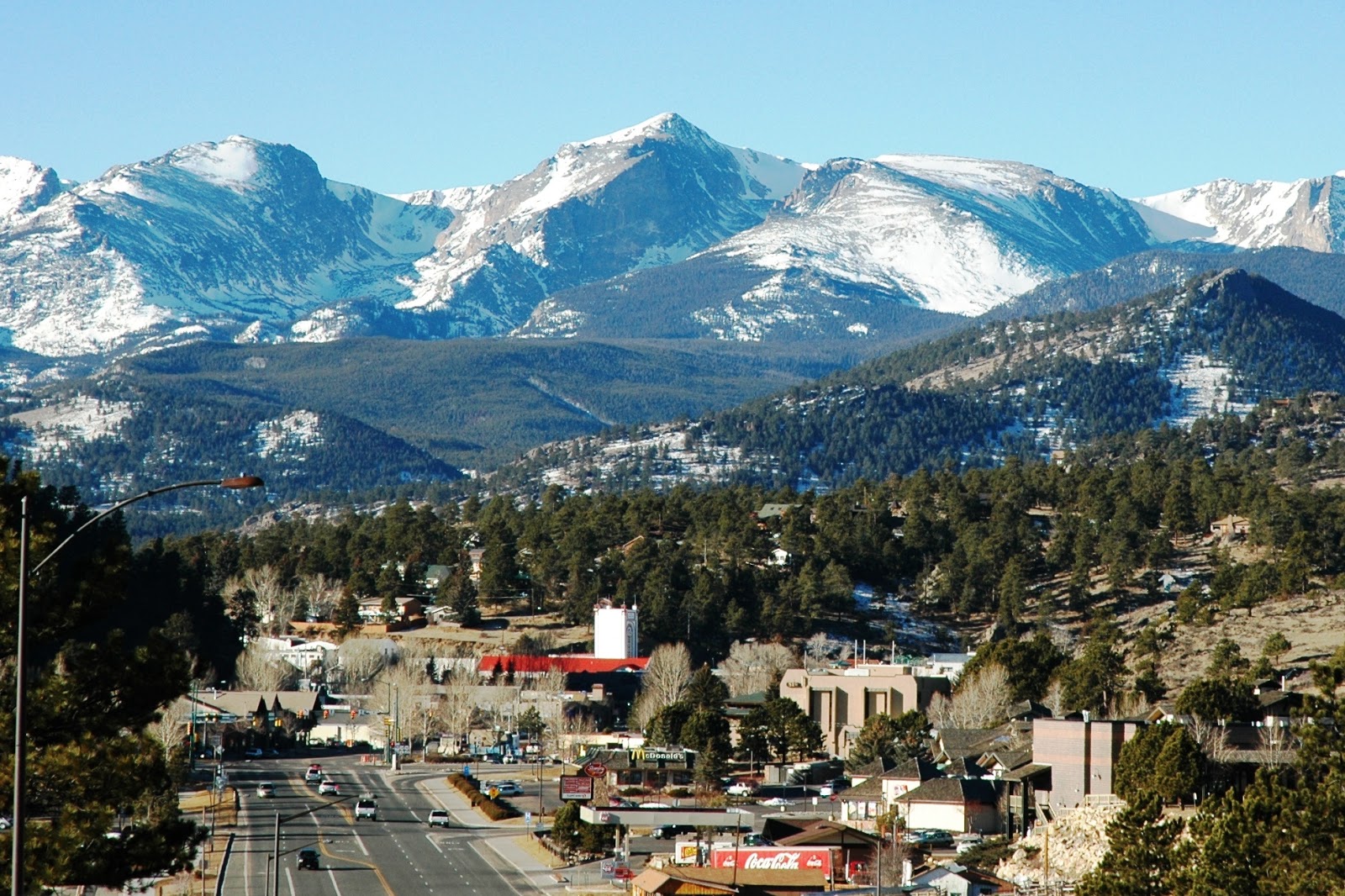
We usually prefer to camp at the national parks, but this time we made an exception. The picturesque town of Estes Park (elevation 7522 ft above sea level) is strategically placed just outside the eastern entrance of the park. Before entering the town, you will be bewildered by the view of Lake Estes with Prospect Mountain (8900 ft) at the backdrop . Over and above the scenic vistas, the town also provides spontaneous interactions with fearless wildlife, which cares little about the existence of human beings or motor vehicles. Your day could start with greetings from an elk while taking a casual morning walk on the hotel lawns, or end with a deer hitchhiking at the side of the highway. The downtown has plenty of colorful shops for gifts and souvenirs, fine art galleries, historical treasures like the Knoll and Birch Cabin, and a beautiful mountain garden named after Mrs. Walsh, which showcases the local flowers and plants meticulously. Either way, you could spend ample quality time in the town itself, without visiting the park.
The picturesque town of Estes Park
Nevertheless, the interiors of the park were sending strong electromagnetic waves to our adventurous minds, and we gladly obliged. Needless to say, we were awestruck, not only by the landscape, but also by the changing colors of the season. The added bonus was countless encounters with the abundant wildlife.

The exploration started at Fall River Visitor Center (8240 ft), which serves as the gateway to the Fall River Area. Towards the Endovalley Road, Alluvial Fan (8610 ft) is a unique attraction for people of all ages and should not be missed. The Roaring River passes through a small waterfall and cascading stream down this area. The top of the waterfall is an easy climb and is a great place for shooting (with camera, off course). The small hiking was just a warm up for the upcoming activities.

Old Fall River Road is a 9 mile long one way dirt road which leads to Alpine Visitor Center at Fall River Pass. Major portions of the road are narrow and interposed with tight switchbacks. It is a challenge for all motorists to go uphill on that super-winding road and enjoy the view at the same time. Just 2 miles up the road, we were blessed by the Chasm Falls, which is one of the many natural wonders inside the park. In one of the switchbacks, I was so mesmerized by the view of Mount Chapin (12454 ft) that I had almost managed to get the car into the Chapin Creek. Thanks to our reflexes for noticing that at the last moment. Near the end of this road, it traverses the headwall of Fall River Cirque before joining Trail Ridge Road next to Alpine Visitor Center (11796 ft).
Chasm Falls at Old Fall River Road
From Alpine Visitor Center one can experience sweeping views of the mountain range, combined with diverse wildlife grazing peacefully on the meadows. The visitor center is located amidst Trail Ridge Road, which is probably the highest continuous paved highway of the nation. Spanning 50 miles between Estes Park on the east and Grand Lake on the southwest, 11 miles of this highway travels above treeline (>11000 ft). Unfortunately, the southwest-bound route was closed due to construction work. That deprived us the visit to Grand Lake and the whole southwestern part of the park, which we regret till date.
Trail Ridge Road from its highest point
Anyway, we had no choice but to detour through the eastbound route. From Fall River Pass to Deer Ridge Junction (8930 ft), this 19 mile stretch winds viciously across the alpine tundra and offers stunning landscapes and magnificent wildflower displays. The highest point of this motorable road (12183 ft) is a couple of miles away from Fall River Pass. The other important pullouts include Gore Range Overlook (12010 ft), Lava Cliffs (12000 ft), Rock Cut (12050 ft) and Forest Canyon Overlook (11716 ft). Near the latter one, we could capture the romantic moods of a number of mule deers, with Sundance Mountain (12466 ft) at the background. Some of them came pretty close to the road and were observing the visitors innocently. In accordance with our previous experience at Yellowstone, those happy-go-lucky guys are more camera-friendly than ever.
An Odocoileus hemionus couple at Forest Canyon
The day ended on a high note with group wildlife watching at multiple sections of West Horseshoe Park and Sheep Lakes (8520 ft).

Day 2
We planned to spend the next day on the southeastern region of the park. So we started from Beaver Meadows Visitor Center (7840 ft) and traveled through Bear Lake Road, which exhibits great scenery throughout its 9 mile length.
Big Thompson River meandering through Moraine Park
On the previous day, we had a glimpse of the wildlife at Moraine Park. This morning that expansive valley was infested with large number of bull elks bugling along with their herd. Oblivious of the human intruders, they seem to enjoy their polygamous lifestyle to the fullest extent. The Moraine Park Visitor Center (8140 ft) houses an excellent museum. The wildlife exhibits and interactive geological displays are quite informative.
A herd of Cervus canadensis at Moraine Park
Around 6 miles on the Bear Lake Road, the tranquil Sprague Lake (8690 ft) emerges out from nowhere. The wheelchair accessible 0.5 mile roundtrip trail adjoining the lake is an easy stroll for all ages. This place is ideal for picnicking, bird watching, fishing, or just relaxing. With a little luck, one can also be able to see elks nearby.

The last portion of Bear Lake Road dramatically winds through striking golden colors of the Aspen leaves, signifying better times ahead. The Bear Lake Perimeter Trail (9475 ft), as the name suggests, spans 0.5 mile surrounding the Bear Lake. True to our expectations, brilliant colors of fall foliage were portrayed on the edge of the lake. We were surprised to find some enthusiastic smaller mammals and birds, who spontaneously posed with us for snaps.
Representative Autumn colors at Bear Lake
After walking around this easy trail, we went up further to explore the series of immaculate lakes. The Emerald Lake Trail starts with Nymph Lake (0.5 mile from trailhead), passes through Dream Lake (1.1 miles) and ends at Emerald Lake (1.8 miles). The trail was fairly steep and gains 605 ft at Emerald Lake from the trailhead. Due to time constraints, we resisted the temptation to hike the Flattop Mountain Trail (9 miles roundtrip), which leads to Flattop Mountain (12324 ft) and Hallett Peak (12713 ft).
The serene Nymph Lake
The next destination was Alberta Falls, a gorgeous waterfall towards Glacier Gorge. This 1.6 miles roundtrip trail starts at Glacier Gorge Trailhead (9240 ft), and it starts out smoothly. After a short time, it gets much steeper and we found ourselves in an open area with panoramic views of the surrounding mountains. This being the final hours of daytime, our energy level had dropped exponentially. Still we managed to complete the trail; our impending Grand Canyon trip served as the inspiration. The Glacier Creek guided us through the rest of trail until the sudden appearance of Alberta Falls upfront. Though the downhill return was relatively easy, our aging knees and hurting feet started to revolt.
Alberta Falls, ornamented by Fall Foliage
The return drive to Estes Park was pretty lively. An elk couple blocked both ways of the road, probably didn’t want us to leave to park. It’s always difficult to say goodbye to them. Convincing them about our future return was also a tough job. After we managed to arrive at Estes Park, we went on to explore the downtown on foot. With the Fall River at its side, the mile-long Riverwalk is a peaceful pathway for pedestrians. As I had said earlier, the town is endowed with a plethora of activities, which did not cease to surprise us.

Day 3
To optimally utilize the residual half day before our return flight, we started early in the morning roaming around Lake Estes. The 3.8 mile trail around the lake was impossible to cover completely in this short time, so we had to be content with half a mile or so. Similar thing happened with the two trails on Peak-to-Peak Scenic Byway, namely the Lily Mountain Trail and the Twin Sisters Trail. These trails lead to, as the names suggest, Lily Mountain (9786 ft) and Twin Sisters Peaks (11428 ft), respectively. Finally, we had to bid adieu to the mountains from the Longs Peak Trailhead, and continued our journey through the same scenic highway.
The tranquil Lily Lake
After exploring most of the accessible areas of the park, we realized that there are still so many things left out. A scenic drive in car with no hiking takes you from sprawling meadows to pristine lakes, from vibrant wildflowers to thick snow above treeline, not to mention the juxtaposed wildlife. But to really identify the hidden treasures of the Rockies, one should heartily spend substantial time and energy on the trails.
Bursting fall colors at "Peak to Peak Scenic Byway"